Accommodation in Kallithea, Halkidiki
Route Paliouri - Avlaki - Loutra Agia Paraskevi 14.19 Km

From Thessaloniki: (1.30 hours) We move along E.Odou Thessaloniki - Kassandreia and take the Exit to
1. Kallithea and then towards Pefkohori – Paliouri
2. Kassandria – Siviri – Agia Paraskevi – Paliouri
Route information for cycling
PALIOURI - AVLAKI - LUTRA GOOD FRIDAY
Starting point: Paliouri
End: Loutra Agia Paraskevi (Thermal Baths - SPA)
Total Distance: 14.19 Km
Minimum Altitude: -1m
Maximum Altitude: 137m
Altitude difference of ascent: 264m
Altitude difference of descent: 365m
Trackpoints: 500
Degree of Difficulty: it is difficult, it has hills, it needs a bike for dirt and in some places it has stones (for a few meters) and it needs special attention!!!
Road conditions : It is a combination of asphalt (3%) and dirt road (96%) and in some places it is with stones (1%).
Route safety: it is a route that a car (jeep) can also follow for greater safety.
In some places you may even come across beehives. because the area is a forest and local honey is produced.
Route Information for Hiking
PALIOURI - AVLAKI - LUTRA GOOD FRIDAY
Starting point: Paliouri
End: Loutra Agia Paraskevi (Thermal Baths - SPA)
Total Distance: 14.19 Km
Minimum Altitude: -1m
Maximum Altitude: 137m
Altitude difference of ascent: 264m
Altitude difference of descent: 365m
Trackpoints: 500
Degree of Difficulty: it is difficult, it has uphills, it needs shoes for dirt and in some places it has stones (for a few meters) and it needs special attention!!!
Road conditions : It is a combination of asphalt (3%) and dirt road (96%) and in some places it is with stones (1%).
Route safety: it is a route that a car (jeep) can also follow for greater safety.
In some places you may even come across beehives. because the area is a forest and local honey is produced.
Track details and analysis
1. (wpt 1)  (altitude = 129m)
The beginning of the route is from the central square of Paliouri
The village has small cafes, taverns, rooms for rent and you can find honey and cheese from the local producers. At a distance of 8 kilometers to the north there are the famous Baths of Agia Paraskevi with the state-of-the-art SPA, while to the south towards the beach you will find hotels and beach bars for your pleasant stay.
We will start our journey straight as the paved road goes.
2. At 90m we meet (wpt 2) 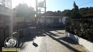 (altitude = 131m)
there is an intersection and we turn right following the paved road.
3. After 93 m (wpt 3) 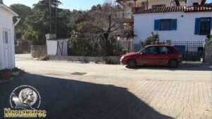 (altitude = 131m)
we will meet an intersection and continue on our way
αριστερά ακολουθώντας τον ασφαλτόδρομο.
4. We continue our course following the central asphalt road until in 150 m we will meet (wpt 4) 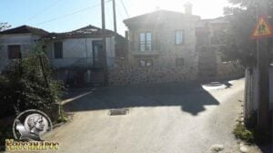 (altitude = 135m)
it has an intersection and we will continue our journey to the left following the asphalt road.
5. At 230 m we will meet (wpt 5) 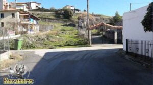 (altitude = 132m)
it has an intersection and we will continue our course to the right following the asphalt road.
6. At 290 m we will meet (wpt 6) 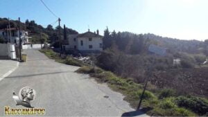 (altitude = 132m)
it has an intersection and we will turn right downhill (it is cobbled with stones) we will continue our route without leaving the main dirt road . It has a sign pointing to Krioneri and Avlaki.
7. At 2.80 km we will meet (wpt 7) 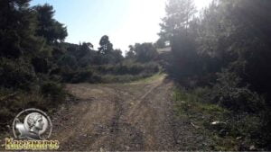 (altitude = 28m)
it has an intersection and we will turn right uphill without leaving the main dirt road.
8. At 3.14 km we will meet (wpt 8)  (altitude = 34m)
it has an intersection and we will turn right uphill without leaving the main dirt road.
(Caution !!! it has stones for a few meters)
9. At 3.47 km we will meet (wpt 9) 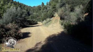 (altitude = 36m)
has an intersection and we will continue our course straight downhill without leaving the main dirt road
10. At 3.62 km ATTENTION !!!! it has an uphill with stones (for 150m) and we will continue our course straight without leaving the main dirt road.
11. At 4.11 km ATTENTION !!!! it has a descent with stones (for 130m) and we will continue our course straight without leaving the main dirt road.
12. At 5.06 km we will meet (wpt 10) 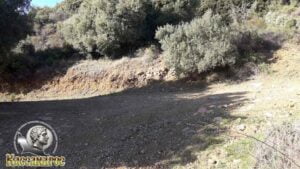 (altitude = 34m)
it has an intersection and we will continue our journey by turning left downhill without leaving the main dirt road.
13. At 5.93 km we will meet (wpt 11) 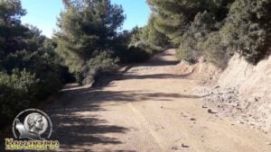 (altitude = 12m)
has an intersection where:
1. To the left we go down to the beach and
2. we will continue our course to the right uphill without leaving the main dirt road.
14. At 6.98 km we will meet (wpt 12) 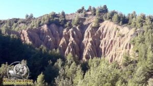 (altitude = 85m)
we will come across an amazing vantage point for photos as we see them
Large Geoforms (Palaces). We will continue our course straight.
15. At 8.87 km we will meet (wpt 13) 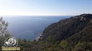 (altitude = 98m)
we will meet an amazing view point for photos as we see the Aegean Sea and central Greece.
16. At 9.29 km we will meet (wpt 14) 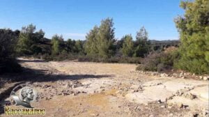 (altitude = 100m)
where there is a triple junction where:
1. Left goes to the Skala area (a rocky area that needs a lot of attention!!!)
2. The dirt road continues downhill to the right and will meet the road from the end of Skala and join just before the beach and
3. Right uphill goes to the top of the mountain.
We will continue our course to the right downhill (option No. 2).
17. At 10.46 km we will meet (wpt 15) 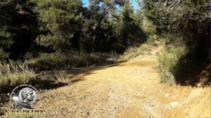 (altitude = 44m)
there is an intersection and we will continue our course turning left downhill without leaving the main dirt road while in some places ( and for a very short time) you will encounter stones as you make your way to the beach.
18. At 11.79 km we will meet (wpt 16) 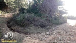 (altitude = 10m)
where there is an intersection:
1. From the left comes the road from the end of Skala and
2. He goes straight to the beach
We will continue our course straight towards the beach (option No 2).
19. At 12.30 km we will meet (wpt 17) 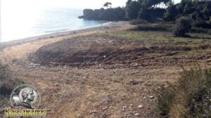 (altitude = 7m)
it has an intersection and we will continue our course left downhill and after 2 m we will go right without leaving the main dirt road
20. At 13.39 km we will meet (wpt 18) 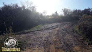 (altitude = 34m)
where there is an intersection, we will continue our course by turning right following the main dirt road
21. At 13.53 km we will meet (wpt 19) 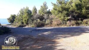 (altitude = 44m)
there is the central intersection with the provincial road of Agia Paraskevi – Loutra Agia Paraskevi (asphalt) where we will turn left towards Loutra Agia Paraskevi.
He needs ATTENTION!!!! for 390m it is the main road and has traffic during the summer months and has no sidewalk on the right or left.
22. At 13.92 km we will meet (wpt 20) 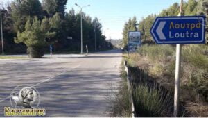 (altitude = 26m)
there is the central intersection to Loutra Agia Paraskevi, we will continue our course turning left uphill.
23. At 14.19 km we will meet (wpt 21) (altitude = 36m) 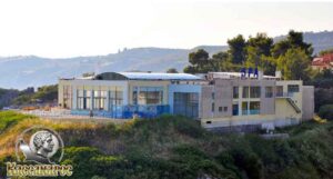
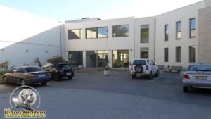
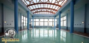
we reach the end of our route. There are the thermal springs and the Municipal Enterprise of the Baths - SPA of Agia Paraskevi where you can enjoy the indoor and outdoor pool with thermal water, which offers beneficial treatments for various body problems. You can also enjoy massage, hammam, jacuzzi and Spa....
The village of Loutra Agia Paraskevi has many rooms for rent, hotels, wonderful taverns and bars to enjoy your walk in the area.
END OF ROUTE
SOURCE: www.kassandra-guide.gr
ASSOCIATION ROOMS-APARTMENTS FOR RENT
HEADQUARTERS: 63077 Kallithea Halkidiki
Phone. : +306978099854
E-mail: ammonzeus2012@gmail.com
The Association Ammon Zeus is an organization based on the idea of individual apartment-enterprises joining together in an association.
Founded in times of an economical crisis, the intention of this community is to support each other in implementing new projects and
to realize new agreements with regional, national and international associations.
Our organization is present at international tourist-fairs, operates in cooperation with local authorities, is involved with environmental protection,
supports development-plans of the region and is represented at cultural events in Kassandra.
New companies are welcome to join our project with the objective to establish further co-operations and enable new possibilities to optimize tourism.
Kassandra is a place with landscapes of unique beauty, a wide variety of local products and warm hospitality. It is our responsibility to represent this region in the best possible way.
Sincerely
GEORGIOS THOMASOULIS
President of Association
Subscribe to our newsletter
Board of Directors of Ammon Zeus Association:
- CHAIRMAN GEORGIOS THOMASOULIS
- VICE PRESIDENT : POPPIS IOANNIS
- G. SECRETARY : CHARALAMPIDIS EFTHYMIOS
- CASHIER: ANTONIADOU FOTEINI
- Deputy G. SECRETARY: LONGINIDIS IOANNIS
- MEMBERS SAKALIS DIMITRIOS
- MEMBERS POPPI CHRISTINA
Ammon Zeus
ASSOCIATION OF ROOMS-APARTMENTS FOR RENT
- HEADQUARTERS: 63077 Kallithea Halkidiki
- Phone: +306978099854
- Email: ammonzeus2012@gmail.com


