Accommodation in Kallithea, Halkidiki
Route Kriopigi - Kassandrino 5.55 km

From Thessaloniki: (1.10 hours) We move on the E.Odu Thessaloniki - Kassandreia and take the Exit to Kallithea - Kriopigi.
Route information for cycling
Κρυοπηγή – Κασσανδρινό
Αφετηρία: Κρυοπηγή
Τερματισμός : Κασσανδρινό
Συνολική διαδρομή : 5,55 χιλιόμετρα
Ελάχιστο Υψόμετρο: 62m
Μέγιστο Υψόμετρο:202m
Υψομετρική διαφορά ανάβασης:117m
Υψομετρική διαφορά κατάβασης:137m
Τrackpoints:204
Βαθμός Δυσκολίας : έχει μια δυσκολία στην αρχή καθώς ανεβαίνουμε μια μεγάλη ανηφόρα (450m), μετά είναι εύκολη καθώς η υπόλοιπη διαδρομή είναι κατάβαση προς το Κασσανδρινο και χώμα..θέλει ποδήλατο για χώμα.
Προσοχή!!! αν η διαδρομή γίνει ανάποδα από το Κασσανδρινό προς Κρυοπηγή είναι πολύ δύσκολη καθώς 4km είναι ανηφόρα.
Συνθήκες δρόμου : Είναι συνδυασμός ασφάλτου (2%) και χωματόδρομου (98%).
Ασφάλεια διαδρομής : είναι διαδρομή που μπορεί και αυτοκίνητο (τζιπ) να ακολουθήσει για μεγαλύτερη ασφάλεια.
Σε κάποια σημεία ίσως συναντήσετε και κυψέλες από μέλισσες. λόγω του ότι στην περιοχή είναι δάσος και παράγεται τοπικό μέλι.
Route Information for Hiking
Κρυοπηγή – Κασσανδρινό
Αφετηρία: Κρυοπηγή
Τερματισμός : Κασσανδρινό
Συνολική διαδρομή : 5,55 χιλιόμετρα
Ελάχιστο Υψόμετρο: 62m
Μέγιστο Υψόμετρο:202m
Υψομετρική διαφορά ανάβασης:117m
Υψομετρική διαφορά κατάβασης:137m
Τrackpoints:204
Βαθμός Δυσκολίας: έχει μια δυσκολία στην αρχή καθώς ανεβαίνουμε μια μεγάλη ανηφόρα (450m), μετά είναι εύκολη καθώς η υπόλοιπη διαδρομή είναι κατάβαση προς το Κασσανδρινο και χώμα θέλει παπούτσια για χώμα .
Προσοχή!!! αν η διαδρομή γίνει ανάποδα από το Κασσανδρινό προς Κρυοπηγή είναι πολύ δύσκολη καθώς 4km είναι ανηφόρα.
Συνθήκες δρόμου : Είναι συνδυασμός ασφάλτου (2%) και χωματόδρομου (98%).
Ασφάλεια διαδρομής : είναι διαδρομή που μπορεί και αυτοκίνητο (τζιπ) να ακολουθήσει για μεγαλύτερη ασφάλεια.
Σε κάποια σημεία ίσως συναντήσετε και κυψέλες από μέλισσες. λόγω του ότι στην περιοχή είναι δάσος και παράγεται τοπικό μέλι.
Track details and analysis
1. (wpt 1) 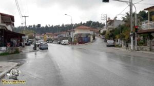 (υψόμετρο = 111m)
The beginning of the route is from the traffic lights of Kriopigi. The village has cafes, taverns, a beach, bars and at a distance of 4 kilometers to Kallithea are the night clubs that the area has... We continue our course to the right uphill to the church of the village of Agios Georgios (it is asphalt).
2. At 150 m, continuing straight, we meet the intersection of the church of Agios Georgios (wpt 2) 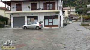 (altitude = 117m)
and we continue our route following the road on the right uphill, it is an asphalt road.
3. After 440 m (wpt 3) 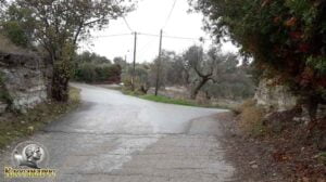 (altitude = 143m)
we will meet an intersection and continue our course straight - slightly left following the main tarmac road.
4. We continue our course following the central asphalt road until at 530 m we will meet (wpt 4)  (altitude = 150m)
it has an intersection and we will continue straight for Kassandrinos (it has a sign).
5. At 1.04 km we will meet (wpt 5) 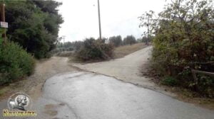 (altitude = 166m)
it has an intersection and we will continue our course to the right towards the concrete road (it has a very old sign) and after 100m it is a dirt road.
6. At 2.35 km we will meet (wpt 6) 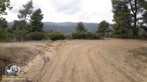 (altitude = 172m)
it has an intersection and we will continue our course to the right downhill without leaving the main dirt road.
7. At 2.55 km we will meet (wpt 7)  (altitude = 150m)
it has an intersection and we will continue our course to the left downhill following the main dirt road.
8. At 2.95 km we will meet (wpt 8) 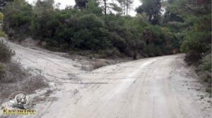 (altitude = 122m)
it has an intersection and we will continue our journey straight downhill following the main dirt road.
9. Στο 3,38 km θα συναντήσουμε το (wpt 9) 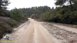 (altitude = 98m)
it has an intersection and we will continue our journey straight downhill following the main dirt road.
10. At 4.13 km we will meet (wpt 10) 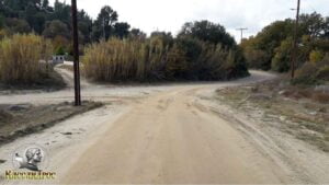 (altitude = 73m)
it has an intersection and we will continue our course to the right following the main dirt road.
11. At 4.27 km we will meet (wpt 11) 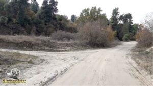 (altitude = 66m)
it has an intersection and we will continue our course to the right following the main dirt road.
12. At 4.86 km we will meet (wpt 12) 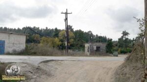 (altitude = 63m)
has an intersection where
1. To the right goes to the village of Fourka
2. Left goes towards Kassandrino
We will continue our course to the left towards Kassandrinos (it is asphalt)
13. At 5.05 km we will meet (wpt 13) 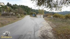 (altitude = 68m)
it has an intersection and we will continue our course left uphill to the central square of Kassandrinos..
14. Στο 5,44 km θα συναντήσουμε το (wpt 14) 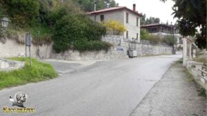 (altitude = 77m)
has an intersection where
1. To the left goes to the village of Polychrono
2. It goes straight to the central square of Kassandrinos
We will continue our course straight to the central square of Kassandrinos (it is asphalt)
15. At 5.55 km we will meet (wpt 15) 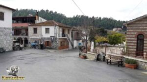 (altitude = 80m)
We arrived at the central Square of the village of Kassandrinos, it has a tap for gargling cold water, a cafe, a church as well as taverns for food and the famous spits..
END OF ROUTE
SOURCE: www.kassandra-guide.gr
ASSOCIATION ROOMS-APARTMENTS FOR RENT
HEADQUARTERS: 63077 Kallithea Halkidiki
Phone. : +306978099854
E-mail: ammonzeus2012@gmail.com
The Association Ammon Zeus is an organization based on the idea of individual apartment-enterprises joining together in an association.
Founded in times of an economical crisis, the intention of this community is to support each other in implementing new projects and
to realize new agreements with regional, national and international associations.
Our organization is present at international tourist-fairs, operates in cooperation with local authorities, is involved with environmental protection,
supports development-plans of the region and is represented at cultural events in Kassandra.
New companies are welcome to join our project with the objective to establish further co-operations and enable new possibilities to optimize tourism.
Kassandra is a place with landscapes of unique beauty, a wide variety of local products and warm hospitality. It is our responsibility to represent this region in the best possible way.
Sincerely
GEORGIOS THOMASOULIS
President of Association
Subscribe to our newsletter
Board of Directors of Ammon Zeus Association:
- CHAIRMAN GEORGIOS THOMASOULIS
- VICE PRESIDENT : POPPIS IOANNIS
- G. SECRETARY : CHARALAMPIDIS EFTHYMIOS
- CASHIER: ANTONIADOU FOTEINI
- Deputy G. SECRETARY: LONGINIDIS IOANNIS
- MEMBERS SAKALIS DIMITRIOS
- MEMBERS POPPI CHRISTINA
Ammon Zeus
ASSOCIATION OF ROOMS-APARTMENTS FOR RENT
- HEADQUARTERS: 63077 Kallithea Halkidiki
- Phone: +306978099854
- Email: ammonzeus2012@gmail.com


