Accommodation in Kallithea, Halkidiki
Route Kassandria - Agia Marina - Fourka - Skala Fourka 8.93 km

Από Θεσσαλονίκη: (50 λεπτά) Κινούμαστε επί της Ε.Οδού Θεσσαλονίκης – Κασσανδρείας και παίρνουμε την Έξοδο προς Κασσάνδρεια.
Route information for cycling
KASSANDREA – AGIA MARINA – FOURKA – SKALA FOURKA
Starting point: Kassandria
Termination: Skala Fourka
Total Route: 8.93 Km
Minimum Altitude: 0m
Maximum Altitude: 110m
Altitude difference of ascent: 82m
Altitude difference of descent: 109m
Τrackpoints:332
Degree of Difficulty: it is moderate to difficult, it requires a bicycle for asphalt and in the area through the forest, for Agia Marina, it requires special attention because the road is narrow (Caution!!! total 3.57 Km), there is traffic from vehicles and especially in the summer months it has more traffic. The rest of the route has a wide road.
Road conditions : It is an asphalt road (100%) and narrow in a certain area.
Route safety: it is a route that a car (jeep) can also follow for greater safety.
In some places you may even come across beehives. because the area is a forest and local honey is produced.
Route Information for Hiking
KASSANDREA – AGIA MARINA – FOURKA – SKALA FOURKA
Starting point: Kassandria
Termination: Skala Fourka
Total Route: 8.93 Km
Minimum Altitude: 0m
Maximum Altitude: 110m
Altitude difference of ascent: 82m
Altitude difference of descent: 109m
Τrackpoints:332
Degree of Difficulty: it is a medium to difficult route, you need shoes for asphalt and in the area through the forest, for Agia Marina, you need special attention because the road is narrow (Caution!!! total 3.57 Km, there is no sidewalk on the right or left), has traffic from vehicles and especially in the summer months it has more traffic. The rest of the route has a wide road.
Road conditions : It is an asphalt road (100%) and narrow in a certain area.
Route safety: it is a route that a car (jeep) can also follow for greater safety.
In some places you may even come across beehives. because the area is a forest and local honey is produced.
Track details and analysis
1. (wpt 1)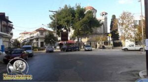
(altitude = 33m)
The start of the route is at the original entrance of the city. Kassandreia is located in the middle of the Kassandra peninsula, it is the seat of the Municipality of Kassandra, as it is the largest village of the peninsula. It is the spiritual, commercial and administrative center of the region and the activities that develop around it, is the Folklore Museum of the Cultural Association of Kassandreia with its dance ensembles, the Municipal Conservatory, the Municipal Philharmonic, , culminating in the Festival of Siviri, which it organizes every year in the open theater of Siviri, they are the best, to make the city a spiritual center.
In the central square of the city, the visitor can take a short break in front of the waters of the waterfall or for some coolness under the century-old old plane tree of the city.
We will start our journey:
1. Passing through and crossing the entire main pedestrian street with the commercial shops and
2. Going towards the City Lights.
We start our march towards the traffic lights
2. At 40 m we meet (wpt 2)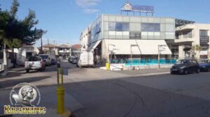
(altitude = 33m)
it has an intersection and we will continue our route following the road to the left.
3. After 110 m (wpt 3)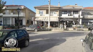
(altitude = 34m)
it has an intersection and we will continue our route following the road to the left passing in front of the new church of Kassandrea.
4. We continue our course until at 380 m we meet (wpt 4)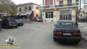
(altitude = 33m)
has an intersection where:
1. On the left is the central square of Kassandria with the centuries-old old plane tree, the pedestrian street ends there,
2. Continue to the right for the exit from Kassandria.
We continue our course to the right.
5. At 400 m we will meet (wpt 5)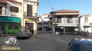
(altitude = 42m)
it has a triple junction and we will continue our course straight uphill.
6. At 600 m we will meet (wpt 6)
(altitude = 45m)
it has a triple intersection and we will continue our course to the left slightly straight towards the exit of Kassandria.
7. At 850 m we will meet (wpt 7)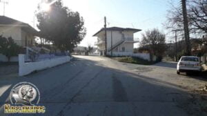
(altitude = 43m)
it has an intersection and we will continue our course to the left uphill
8. At 1.53 km we will meet (wpt 8)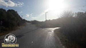
(altitude = 72m)
where the intersection is located (it also has a sign) to:
1. Left goes to Kriopigi, Paleokastro and Kassandrino (asphalt) and
2. Right goes to Agia Marina, Fourka (asphalt)
We continue our course to the right towards Agia Marina through the forest.
9. At 3.92 km we will meet (wpt 9)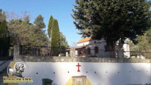
(altitude = 70m)
we arrived at the Agia Marina church. On July 16, the eve of her feast day
Agia Marina, there is a festival - a feast in the square of the village of Fourka with traditional music and dance by the Cultural Association of Fourka.
10. At 5.10 km we will meet (wpt 10)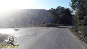
(altitude = 48m)
where the intersection is located (it also has a sign) to:
1. To the left goes to the village of Kassandrino (asphalt) and
2. Right goes to the village of Fourka (asphalt)
We continue our course to the right towards the village of Fourka.
11. At 5.99 km we will meet (wpt 11) (altitude = 40m ),
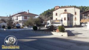
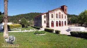
there is the central square of Fourka and the central church of Fourka is dedicated to the Three Hierarchs and was built according to the designs of Fourkiot Architect Xenophon Paionidis.
We continue our course straight following the asphalt towards the exit of the village.
12. At 8.35 km we will meet (wpt 12)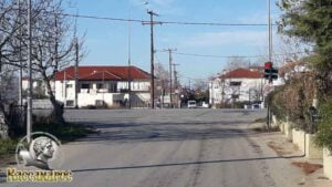
(altitude = 11m)
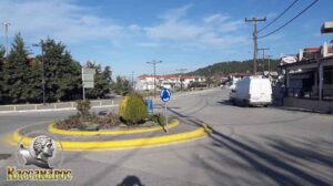
it has the central intersection of E.O Kalandra - Kassandria and we will continue our course straight - perpendicular to the beach of Skala Fourka.
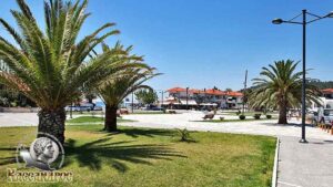
13. At 8.93 km we will meet (wpt 13) (altitude = 1m) we will meet the central square of Skala Fourka
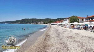
Skala Fourkas has a sandy beach with very fine pebbles, a wonderful sunset, fish taverns known for the quality of its fish, rooms for rent, hotels for your best stay as well as cafes, bars and nightlife to enjoy your walk in the area.
END OF ROUTE
SOURCE: www.kassandra-guide.gr
ASSOCIATION ROOMS-APARTMENTS FOR RENT
HEADQUARTERS: 63077 Kallithea Halkidiki
Phone. : +306978099854
E-mail: ammonzeus2012@gmail.com
The Association Ammon Zeus is an organization based on the idea of individual apartment-enterprises joining together in an association.
Founded in times of an economical crisis, the intention of this community is to support each other in implementing new projects and
to realize new agreements with regional, national and international associations.
Our organization is present at international tourist-fairs, operates in cooperation with local authorities, is involved with environmental protection,
supports development-plans of the region and is represented at cultural events in Kassandra.
New companies are welcome to join our project with the objective to establish further co-operations and enable new possibilities to optimize tourism.
Kassandra is a place with landscapes of unique beauty, a wide variety of local products and warm hospitality. It is our responsibility to represent this region in the best possible way.
Sincerely
GEORGIOS THOMASOULIS
President of Association
Subscribe to our newsletter
Board of Directors of Ammon Zeus Association:
- CHAIRMAN GEORGIOS THOMASOULIS
- VICE PRESIDENT : POPPIS IOANNIS
- G. SECRETARY : CHARALAMPIDIS EFTHYMIOS
- CASHIER: ANTONIADOU FOTEINI
- Deputy G. SECRETARY: LONGINIDIS IOANNIS
- MEMBERS SAKALIS DIMITRIOS
- MEMBERS POPPI CHRISTINA
Ammon Zeus
ASSOCIATION OF ROOMS-APARTMENTS FOR RENT
- HEADQUARTERS: 63077 Kallithea Halkidiki
- Phone: +306978099854
- Email: ammonzeus2012@gmail.com


